 vesseltracker.com
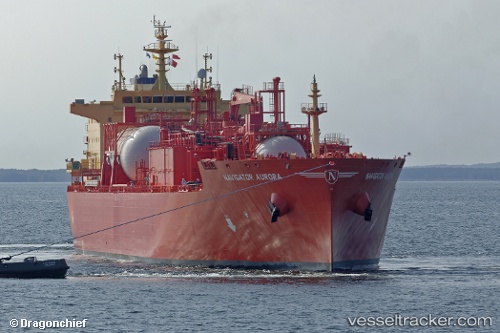
 Navigator Aurora
Current Status
Where is the vessel?
Navigator Aurora is currently in 105 nm W of Corcos, based on AIS data received less than 1h ago.
Latest AIS update:
Current position: 41.19503° N, 46.35206° W (105 nm W of Corcos)
Average speed (last 7 days): Loading…
Average speed (last 30 days): Loading…
Vessel profile: Navigator Aurora is a Lpg Tanker with dimensions 179m x 180m.
This page combines live AIS, route history, probable destination signals, nearby traffic, and port activity for practical vessel monitoring.
The current position of vessel Navigator Aurora is 41.19503 lat / -46.35206 lng. Updated: 2026-05-14 16:26:51 UTCCurrently sailing under the flag of Liberia ![]()
Details:
Live Vessel Navigator Aurora Analytics (details, animations, etc.)
Recent AIS points (UTC):
2026-05-14 13:51:12 UTC · 41.08212, -47.05567 · SOG 13.1 kn · COG 78°2026-05-14 13:56:32 UTC · 41.08577, -47.03049 · SOG 13.1 kn · COG 77°
2026-05-14 16:26:51 UTC · 41.19503, -46.35206 · SOG 13.2 kn · COG 78°
2026-05-14 16:26:51 UTC · 41.19503, -46.35206 · SOG 13.2 kn · COG 78°