 vesseltracker.com
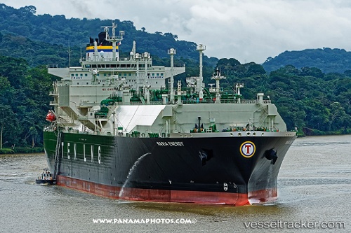
Maria Energy
Current StatusWhere is the vessel?
Maria Energy is currently in Open sea, approx. 434 nm off the nearest listed port, based on AIS data received about 4h ago.
Latest AIS update:
Current position: 17.45691° N, 130.84608° E (Open sea, approx. 434 nm off the nearest listed port)
Average speed (last 7 days): Loading…
Average speed (last 30 days): Loading…
Vessel profile: Maria Energy is a Lng Tanker with dimensions 46m x 289m.
This page combines live AIS, route history, probable destination signals, nearby traffic, and port activity for practical vessel monitoring.
The current position of vessel Maria Energy is 17.45691 lat / 130.84608 lng. Updated: 2026-04-28 02:13:50 UTCNearest reference points:
- Open sea, approx. 434 nm off the nearest listed port
- Open sea, approx. 433 nm off the nearest listed port
- Open sea, approx. 430 nm off the nearest listed port
Details:
Live Vessel Maria Energy Analytics (details, animations, etc.)
Recent AIS points (UTC):
2026-04-27 22:41:29 UTC · 16.72567, 131.20682 · SOG 14.4 kn · COG 335°2026-04-28 02:13:50 UTC · 17.45691, 130.84608 · SOG 13.8 kn · COG 342°
2026-04-28 02:13:50 UTC · 17.45691, 130.84608 · SOG 13.8 kn · COG 342°
2026-04-28 02:13:50 UTC · 17.45691, 130.84608 · SOG 13.8 kn · COG 342°