 vesseltracker.com
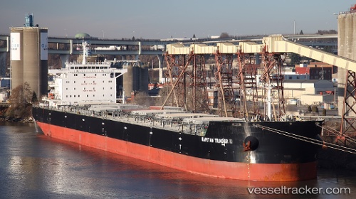
Star Charis
Current StatusWhere is the vessel?
Star Charis is currently in Near Fray Luis A. Beltrán, based on AIS data received less than 1h ago.
Latest AIS update:
Current position: 32.77269° S, 60.72043° W (Near Fray Luis A. Beltrán)
Average speed (last 7 days): Loading…
Average speed (last 30 days): Loading…
Vessel profile: Star Charis is a Bulk Carrier with dimensions 32m x 229m.
This page combines live AIS, route history, probable destination signals, nearby traffic, and port activity for practical vessel monitoring.
The current position of vessel Star Charis is -32.77269 lat / -60.72043 lng. Updated: 2026-04-23 23:00:46 UTCNearest reference points:
- Near Quebracho/San Lorenzo
- Near Puerto Alumbrera
- 10 nm NW of San Pedro
Details:
Live Vessel Star Charis Analytics (details, animations, etc.)
Recent AIS points (UTC):
2026-04-23 19:18:02 UTC · -32.77090, -60.71605 · SOG 0.1 kn · COG 344°2026-04-23 20:16:12 UTC · -32.77105, -60.71833 · SOG 1.1 kn · COG 317°
2026-04-23 21:48:51 UTC · -32.77273, -60.72036 · SOG 0.1 kn · COG 337°
2026-04-23 23:00:46 UTC · -32.77269, -60.72043 · SOG 0 kn · COG 337°