 vesseltracker.com
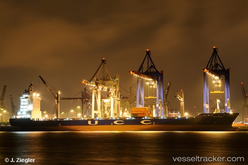
 Hsl Paraty
Current Status
Where is the vessel?
Hsl Paraty is currently in 41 nm N of Los Organos, based on AIS data received less than 1h ago.
Latest AIS update:
Current position: 3.50835° S, 81.08957° W (41 nm N of Los Organos)
Average speed (last 7 days): Loading…
Average speed (last 30 days): Loading…
Vessel profile: Hsl Paraty is a Container Ship with dimensions 207m x 30m.
This page combines live AIS, route history, probable destination signals, nearby traffic, and port activity for practical vessel monitoring.
The current position of vessel Hsl Paraty is -3.50835 lat / -81.08957 lng. Updated: 2026-05-15 16:18:57 UTCNearest reference points:
- Near La Libertad
- Near PAITA
- Near Guayaquil
Currently sailing under the flag of Liberia ![]()
Hsl Paraty built in 2004 year
Deadweight:
33794 tDetails:
Live Vessel Hsl Paraty Analytics (details, animations, etc.)
Recent AIS points (UTC):
2026-05-15 13:46:10 UTC · -3.09378, -80.75502 · SOG 12.6 kn · COG 222°2026-05-15 13:48:26 UTC · -3.09982, -80.76031 · SOG 12.4 kn · COG 221°
2026-05-15 16:04:18 UTC · -3.46564, -81.05953 · SOG 12.5 kn · COG 215°
2026-05-15 16:18:57 UTC · -3.50835, -81.08957 · SOG 12.9 kn · COG 214°