 vesseltracker.com
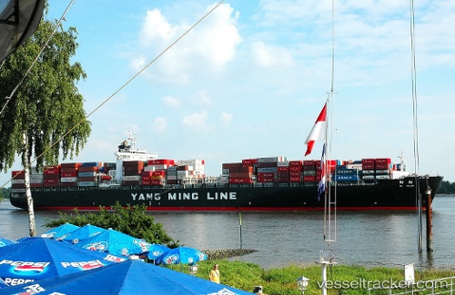
 Ym Plum
Current Status
Where is the vessel?
Ym Plum is currently in Near YUNG AN, based on AIS data received about 2h ago.
Latest AIS update:
Current position: 22.73918° N, 120.05512° E (Near YUNG AN)
Average speed (last 7 days): Loading…
Average speed (last 30 days): Loading…
Vessel profile: Ym Plum is a Container Ship with dimensions 274m x 40m.
This page combines live AIS, route history, probable destination signals, nearby traffic, and port activity for practical vessel monitoring.
The current position of vessel Ym Plum is 22.73918 lat / 120.05512 lng. Updated: 2026-04-30 19:30:51 UTCNearest reference points:
- Near Tso-Ying
- Near YUNG AN
- Near Kao-Hsiung Kang
Currently sailing under the flag of Liberia ![]()
Ym Plum built in 2000 year
Deadweight:
68413 tDetails:
Live Vessel Ym Plum Analytics (details, animations, etc.)
Recent AIS points (UTC):
2026-04-30 16:13:17 UTC · 23.13053, 119.88976 · SOG 8.1 kn · COG 192°2026-04-30 17:36:16 UTC · 22.95868, 119.93045 · SOG 8.7 kn · COG 145°
2026-04-30 19:14:26 UTC · 22.75981, 120.02869 · SOG 7.4 kn · COG 127°
2026-04-30 19:30:51 UTC · 22.73918, 120.05512 · SOG 7 kn · COG 125°