 vesseltracker.com
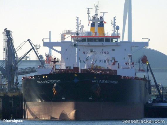
 Cielo Di Rotterdam
Current Status
Where is the vessel?
Cielo Di Rotterdam is currently in 319 nm SE of Efpalion, based on AIS data received less than 1h ago.
Latest AIS update:
Current position: 19.05500° N, 34.39167° W (319 nm SE of Efpalion)
Average speed (last 7 days): Loading…
Average speed (last 30 days): Loading…
Vessel profile: Cielo Di Rotterdam is a Oil Products Tanker with dimensions 228m x 36m.
This page combines live AIS, route history, probable destination signals, nearby traffic, and port activity for practical vessel monitoring.
The current position of vessel Cielo Di Rotterdam is 19.05500 lat / -34.39167 lng. Updated: 2026-04-29 13:54:42 UTCNearest reference points:
- Open sea, approx. 401 nm off the nearest listed port
- Open sea, approx. 404 nm off the nearest listed port
- Open sea, approx. 407 nm off the nearest listed port
Currently sailing under the flag of Liberia ![]()
Details:
Live Vessel Cielo Di Rotterdam Analytics (details, animations, etc.)
Recent AIS points (UTC):
2026-04-29 10:51:43 UTC · 19.38500, -34.99500 · SOG 13 kn · COG -1°2026-04-29 11:20:48 UTC · 19.33238, -34.90022 · SOG 12.9 kn · COG 119°
2026-04-29 13:01:58 UTC · 19.15013, -34.56882 · SOG 13.3 kn · COG 117°
2026-04-29 13:54:42 UTC · 19.05500, -34.39167 · SOG 12 kn · COG -1°