 vesseltracker.com
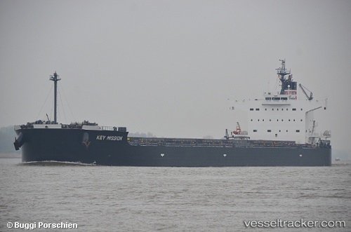
Blue Ridge
Current StatusWhere is the vessel?
Blue Ridge is currently in 32 nm E of Kakap Natuna Terminal, based on AIS data received about 2h ago.
Latest AIS update:
Current position: 4.99400° N, 106.47800° E (32 nm E of Kakap Natuna Terminal)
Average speed (last 7 days): Loading…
Average speed (last 30 days): Loading…
Vessel profile: Blue Ridge is a Bulk Carrier with dimensions 32m x 229m.
This page combines live AIS, route history, probable destination signals, nearby traffic, and port activity for practical vessel monitoring.
The current position of vessel Blue Ridge is 4.99400 lat / 106.47800 lng. Updated: 2026-04-16 09:35:53 UTCNearest reference points:
- 45 nm E of Kakap Natuna Terminal
- 46 nm E of Kakap Natuna Terminal
- 36 nm SW of Slipi
Details:
Live Vessel Blue Ridge Analytics (details, animations, etc.)
Recent AIS points (UTC):
2026-04-16 03:16:54 UTC · 3.99857, 105.76588 · SOG 12 kn · COG 47°2026-04-16 04:20:13 UTC · 4.16471, 105.89552 · SOG 11.8 kn · COG 44°
2026-04-16 07:42:26 UTC · 4.70167, 106.26667 · SOG 11 kn · COG -1°
2026-04-16 09:35:53 UTC · 4.99400, 106.47800 · SOG 11.3 kn · COG 33°