 vesseltracker.com
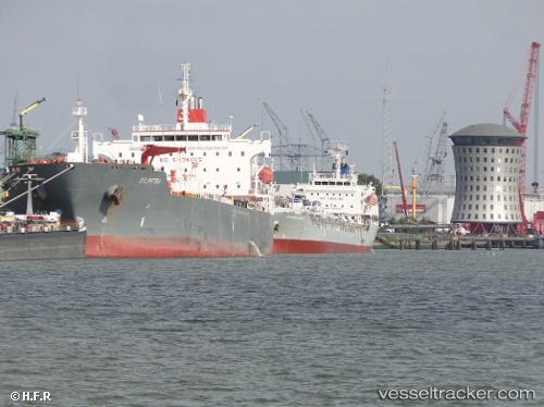
 Aquarius
Current Status
Where is the vessel?
Aquarius is currently in 265 nm NW of Georgetown, based on AIS data received less than 1h ago.
Latest AIS update:
Current position: 4.63101° S, 17.37835° W (265 nm NW of Georgetown)
Average speed (last 7 days): Loading…
Average speed (last 30 days): Loading…
Vessel profile: Aquarius is a Chemical Oil Products Tanker with dimensions 183m x 183m.
This page combines live AIS, route history, probable destination signals, nearby traffic, and port activity for practical vessel monitoring.
The current position of vessel Aquarius is -4.63101 lat / -17.37835 lng. Updated: 2026-05-14 23:46:16 UTCNearest reference points:
- Open sea, approx. 401 nm off the nearest listed port
- Open sea, approx. 402 nm off the nearest listed port
- Open sea, approx. 403 nm off the nearest listed port
Currently sailing under the flag of Liberia ![]()
Aquarius built in 2007 year
Deadweight:
51288 tDetails:
Live Vessel Aquarius Analytics (details, animations, etc.)
Recent AIS points (UTC):
2026-05-14 19:50:45 UTC · -5.30838, -16.84453 · SOG 13.2 kn · COG 323°2026-05-14 22:22:24 UTC · -4.87263, -17.18880 · SOG 13 kn · COG 322°
2026-05-14 22:53:57 UTC · -4.78333, -17.26167 · SOG 13 kn · COG -1°
2026-05-14 23:46:16 UTC · -4.63101, -17.37835 · SOG 12.9 kn · COG 325°