 vesseltracker.com
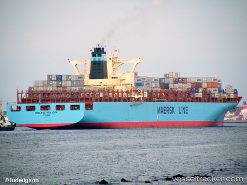
York
Current StatusWhere is the vessel?
York is currently in 13 nm W of Colombo, based on AIS data received less than 1h ago.
Latest AIS update:
Current position: 7.01591° N, 79.64827° E (13 nm W of Colombo)
Average speed (last 7 days): Loading…
Average speed (last 30 days): Loading…
Vessel profile: York is a Container Ship with dimensions 40m x 304m.
This page combines live AIS, route history, probable destination signals, nearby traffic, and port activity for practical vessel monitoring.
The current position of vessel York is 7.01591 lat / 79.64827 lng. Updated: 2026-05-15 14:21:25 UTCNearest reference points:
- 19 nm SW of Bataduwa
- 67 nm SW of Moratuwa
- 82 nm W of Moratuwa
Details:
Live Vessel York Analytics (details, animations, etc.)
Recent AIS points (UTC):
2026-05-15 10:39:26 UTC · 7.01608, 79.64822 · SOG 0.1 kn · COG 250°2026-05-15 11:33:29 UTC · 7.01614, 79.64813 · SOG 0.1 kn · COG 249°
2026-05-15 13:42:24 UTC · 7.01607, 79.64820 · SOG 0.2 kn · COG 254°
2026-05-15 14:21:25 UTC · 7.01591, 79.64827 · SOG 0.4 kn · COG 250°