 vesseltracker.com
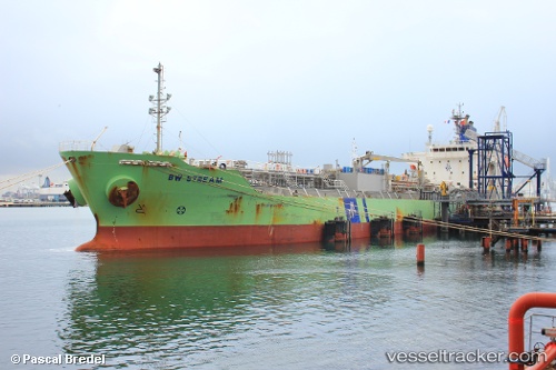
 Chem Stream
Current Status
Where is the vessel?
Chem Stream is currently in 16 nm E of TALIARTE, based on AIS data received about 1h ago.
Latest AIS update:
Current position: 27.96840° N, 15.07227° W (16 nm E of TALIARTE)
Average speed (last 7 days): Loading…
Average speed (last 30 days): Loading…
Vessel profile: Chem Stream is a Chemical Oil Products Tanker with dimensions 144m x 144m.
This page combines live AIS, route history, probable destination signals, nearby traffic, and port activity for practical vessel monitoring.
The current position of vessel Chem Stream is 27.96840 lat / -15.07227 lng. Updated: 2026-04-28 00:10:15 UTCNearest reference points:
- Near TALIARTE
- Near Las Palmas de Gran Canaria
- Near Las Palmas
Currently sailing under the flag of Liberia ![]()
Chem Stream built in 2010 year
Deadweight:
19998 tDetails:
Live Vessel Chem Stream Analytics (details, animations, etc.)
Recent AIS points (UTC):
2026-04-27 19:46:39 UTC · 28.85548, -14.76818 · SOG 12.8 kn · COG 192°2026-04-27 22:11:05 UTC · 28.35975, -14.91888 · SOG 12.3 kn · COG 195°
2026-04-27 22:57:05 UTC · 28.20845, -14.97587 · SOG 12.4 kn · COG 200°
2026-04-28 00:10:15 UTC · 27.96840, -15.07227 · SOG 12.6 kn · COG 203°