 vesseltracker.com
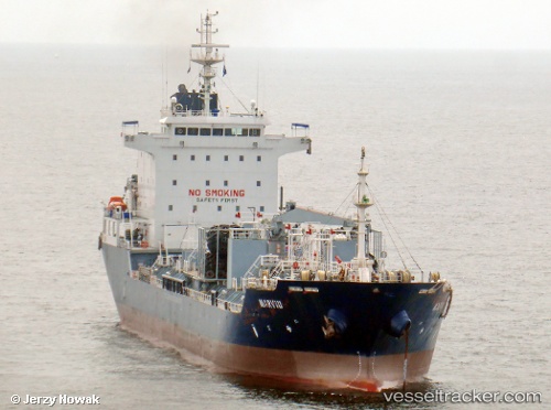
 SARONIC BAY
Current Status
Where is the vessel?
SARONIC BAY is currently in 226 nm S of Quequen, based on AIS data received less than 1h ago.
Latest AIS update:
Current position: 42.13500° S, 57.03500° W (226 nm S of Quequen)
Average speed (last 7 days): Loading…
Average speed (last 30 days): Loading…
Vessel profile: SARONIC BAY is a Chemical/Oil Products Tanker with dimensions 20m x 128m.
This page combines live AIS, route history, probable destination signals, nearby traffic, and port activity for practical vessel monitoring.
The current position of vessel SARONIC BAY is -42.13500 lat / -57.03500 lng. Updated: 2026-04-24 22:04:40 UTCNearest reference points:
- 186 nm S of Quequen
Currently sailing under the flag of Liberia ![]()
SARONIC BAY built in 2011 year
Deadweight:
13151 tDetails:
Live Vessel SARONIC BAY Analytics (details, animations, etc.)
Recent AIS points (UTC):
2026-04-24 18:15:19 UTC · -42.16167, -57.11500 · SOG 2 kn · COG -1°2026-04-24 19:39:50 UTC · -42.14833, -57.07500 · SOG 1 kn · COG -1°
2026-04-24 19:57:55 UTC · -42.14500, -57.06833 · SOG 1 kn · COG -1°
2026-04-24 22:04:40 UTC · -42.13500, -57.03500 · SOG 0 kn · COG -1°