 vesseltracker.com
 MAROULIO S
Current Status
Where is the vessel?
MAROULIO S is currently in Near JAIGAD, based on AIS data received less than 1h ago.
Latest AIS update:
Current position: 17.31327° N, 73.07128° E (Near JAIGAD)
Average speed (last 7 days): Loading…
Average speed (last 30 days): Loading…
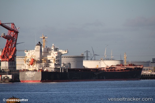
Vessel profile: MAROULIO S is a Bulk Carrier with dimensions 175m x 31m.
This page combines live AIS, route history, probable destination signals, nearby traffic, and port activity for practical vessel monitoring.
The current position of vessel MAROULIO S is 17.31327 lat / 73.07128 lng. Updated: 2026-04-30 19:08:48 UTCNearest reference points:
- Near JAIGAD
- 49 nm W of Pernem
- Near Mumbai
Currently sailing under the flag of Liberia ![]()
MAROULIO S built in 2010 year
Deadweight:
75700 tDetails:
Live Vessel MAROULIO S Analytics (details, animations, etc.)
Recent AIS points (UTC):
2026-04-30 15:50:49 UTC · 17.31649, 73.07079 · SOG 0 kn · COG 213°2026-04-30 16:32:45 UTC · 17.31660, 73.07061 · SOG 0.1 kn · COG 205°
2026-04-30 17:52:30 UTC · 17.31500, 73.07000 · SOG 0 kn · COG -1°
2026-04-30 19:08:48 UTC · 17.31327, 73.07128 · SOG 0 kn · COG 322°