 vesseltracker.com
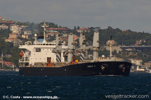
 Amber S
Current Status
Where is the vessel?
Amber S is currently in 10 nm SE of Marmara Ereglisi, based on AIS data received about 1h ago.
Latest AIS update:
Current position: 40.82779° N, 28.10158° E (10 nm SE of Marmara Ereglisi)
Average speed (last 7 days): Loading…
Average speed (last 30 days): Loading…
Vessel profile: Amber S is a Crude Oil Tanker with dimensions 185m x 30m.
This page combines live AIS, route history, probable destination signals, nearby traffic, and port activity for practical vessel monitoring.
The current position of vessel Amber S is 40.82779 lat / 28.10158 lng. Updated: 2026-04-26 06:08:30 UTCNearest reference points:
- Near Saraylar
- 11 nm E of Erdek
- Near Gürpinar
Currently sailing under the flag of Liberia ![]()
Amber S built in 2000 year
Deadweight:
47282 tDetails:
Live Vessel Amber S Analytics (details, animations, etc.)
Recent AIS points (UTC):
2026-04-26 01:44:28 UTC · 40.94076, 28.83926 · SOG 0.7 kn · COG -1°2026-04-26 03:53:51 UTC · 40.87591, 28.52150 · SOG 8.9 kn · COG -1°
2026-04-26 04:22:20 UTC · 40.86607, 28.42975 · SOG 8.9 kn · COG -1°
2026-04-26 06:08:30 UTC · 40.82779, 28.10158 · SOG 8.3 kn · COG -1°