 vesseltracker.com
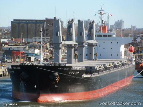
 KERASIA S
Current Status
Where is the vessel?
KERASIA S is currently in 49 nm NE of Bowers Gifford, based on AIS data received less than 1h ago.
Latest AIS update:
Current position: 56.26167° N, 6.59667° E (49 nm NE of Bowers Gifford)
Average speed (last 7 days): Loading…
Average speed (last 30 days): Loading…
Vessel profile: KERASIA S is a General Cargo Ship with dimensions 177m x 28m.
This page combines live AIS, route history, probable destination signals, nearby traffic, and port activity for practical vessel monitoring.
The current position of vessel KERASIA S is 56.26167 lat / 6.59667 lng. Updated: 2026-05-14 16:08:46 UTCNearest reference points:
- 36 nm W of HVIDE SANDE
- Near Blavand
- Near Thyborøn
Currently sailing under the flag of Liberia ![]()
KERASIA S built in 2011 year
Deadweight:
33170 tDetails:
Live Vessel KERASIA S Analytics (details, animations, etc.)
Recent AIS points (UTC):
2026-05-14 13:38:28 UTC · 55.84104, 6.20258 · SOG 11.3 kn · COG 29°2026-05-14 13:44:46 UTC · 55.85833, 6.21833 · SOG 11 kn · COG -1°
2026-05-14 16:05:48 UTC · 56.25333, 6.58667 · SOG 11 kn · COG -1°
2026-05-14 16:08:46 UTC · 56.26167, 6.59667 · SOG 11 kn · COG -1°