 vesseltracker.com
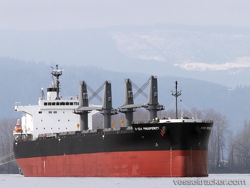
 LUNA ROSSA
Current Status
Where is the vessel?
LUNA ROSSA is currently in 79 nm E of Yangkou Pt, based on AIS data received less than 1h ago.
Latest AIS update:
Current position: 32.84074° N, 122.92123° E (79 nm E of Yangkou Pt)
Average speed (last 7 days): Loading…
Average speed (last 30 days): Loading…
Vessel profile: LUNA ROSSA is a Bulk Carrier with dimensions 32m x 200m.
This page combines live AIS, route history, probable destination signals, nearby traffic, and port activity for practical vessel monitoring.
The current position of vessel LUNA ROSSA is 32.84074 lat / 122.92123 lng. Updated: 2026-05-14 04:15:59 UTCNearest reference points:
- 79 nm NE of Yangkou Pt
- 99 nm NE of Yangkou Pt
- 77 nm NE of Jingjiang
Currently sailing under the flag of Liberia ![]()
LUNA ROSSA built in 2010 year
Deadweight:
61645 tDetails:
Live Vessel LUNA ROSSA Analytics (details, animations, etc.)
Recent AIS points (UTC):
2026-05-14 01:16:50 UTC · 32.26164, 123.05621 · SOG 12 kn · COG 348°2026-05-14 01:16:50 UTC · 32.26164, 123.05621 · SOG 12 kn · COG 348°
2026-05-14 03:04:20 UTC · 32.60954, 122.95618 · SOG 11 kn · COG 337°
2026-05-14 04:15:59 UTC · 32.84074, 122.92123 · SOG 11.7 kn · COG 351°