 vesseltracker.com
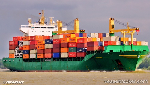
 MSC SAMU
Current Status
Where is the vessel?
MSC SAMU is currently in 21 nm SE of Espoir, based on AIS data received less than 1h ago.
Latest AIS update:
Current position: 4.86200° N, 4.10033° W (21 nm SE of Espoir)
Average speed (last 7 days): Loading…
Average speed (last 30 days): Loading…
Vessel profile: MSC SAMU is a Container Ship with dimensions 207m x 32m.
This page combines live AIS, route history, probable destination signals, nearby traffic, and port activity for practical vessel monitoring.
The current position of vessel MSC SAMU is 4.86200 lat / -4.10033 lng. Updated: 2026-05-15 16:36:51 UTCNearest reference points:
- Near Espoir
- Near Vridi
- Near Abidjan
Currently sailing under the flag of Liberia ![]()
MSC SAMU built in 2001 year
Deadweight:
35653 tDetails:
Live Vessel MSC SAMU Analytics (details, animations, etc.)
Recent AIS points (UTC):
2026-05-15 13:02:14 UTC · 5.06317, -4.05567 · SOG 6.7 kn · COG 284°2026-05-15 13:52:22 UTC · 5.05350, -4.05750 · SOG 1.8 kn · COG 144°
2026-05-15 15:58:12 UTC · 4.94200, -4.08533 · SOG 7.5 kn · COG 198°
2026-05-15 16:36:51 UTC · 4.86200, -4.10033 · SOG 7.2 kn · COG 192°