 vesseltracker.com
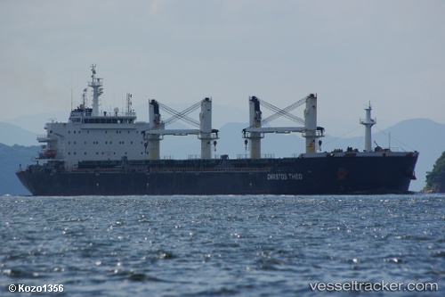
 CHRIS
CHRIS
Current Status
Where is the vessel?
CHRIS is currently in Near DUNG QUAT, based on AIS data received about 1h ago.
Latest AIS update:
Current position: 15.40322° N, 108.80120° E (Near DUNG QUAT)
Average speed (last 7 days): Loading…
Average speed (last 30 days): Loading…
Vessel profile: CHRIS is a Bulk Carrier with dimensions 32m x 190m.
This page combines live AIS, route history, probable destination signals, nearby traffic, and port activity for practical vessel monitoring.
The current position of vessel CHRIS is 15.40322 lat / 108.80120 lng. Updated: 2026-04-27 22:16:56 UTCNearest reference points:
- Near DUNG QUAT
- Near Thuan An
- 23 nm E of Hai Son
Currently sailing under the flag of Liberia ![]()
CHRIS built in 2010 year
Deadweight:
56838 tDetails:
Live Vessel CHRIS Analytics (details, animations, etc.)
Recent AIS points (UTC):
2026-04-27 19:24:52 UTC · 15.40330, 108.80140 · SOG 0 kn · COG 51°2026-04-27 20:16:54 UTC · 15.40325, 108.80138 · SOG 0 kn · COG 51°
2026-04-27 21:40:53 UTC · 15.40328, 108.80133 · SOG 0 kn · COG 51°
2026-04-27 22:16:56 UTC · 15.40322, 108.80120 · SOG 0 kn · COG 51°