 vesseltracker.com
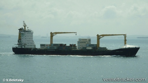
Vessel MSC OLGA F IMO: 9336359, MMSI: 636021017 Container Ship
UTC, 31.23824, 29.72539, course: 326, speed: 0.3
UTC, 31.23813, 29.72513, course: 340, speed: 0.4
2026-02-27 08:23:20 UTC, 31.23807, 29.72385, course: 6, speed: 0.3
Live AIS position:
UTC. Near EL DEKHEILA),
updated 2026-02-27 08:23:20 UTC.
Find the position of the vessel MSC OLGA F on the map. The latter are known coordinates and path.
marine traffic ship tracker show on live map
The current position of vessel MSC OLGA F is 31.23807 lat / 29.72385 lng. Updated: 2026-02-27 08:23:20 UTCCurrently sailing under the flag of Liberia
MSC OLGA F built in 2006 year
Deadweight:
13775 tDetails:
Last coordinates of the vessel:
UTC, 31.23826, 29.72535, course: 345, speed: 0.1UTC, 31.23824, 29.72539, course: 326, speed: 0.3
UTC, 31.23813, 29.72513, course: 340, speed: 0.4
2026-02-27 08:23:20 UTC, 31.23807, 29.72385, course: 6, speed: 0.3