 vesseltracker.com
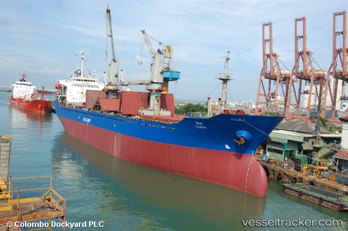
 FISHER
Current Status
Where is the vessel?
FISHER is currently in Near HEREKE, based on AIS data received less than 1h ago.
Latest AIS update:
Current position: 40.77748° N, 29.60137° E (Near HEREKE)
Average speed (last 7 days): Loading…
Average speed (last 30 days): Loading…
Vessel profile: FISHER is a General Cargo Ship with dimensions 22m x 128m.
This page combines live AIS, route history, probable destination signals, nearby traffic, and port activity for practical vessel monitoring.
The current position of vessel FISHER is 40.77748 lat / 29.60137 lng. Updated: 2026-05-15 23:59:46 UTCNearest reference points:
- Near Diliskelesi
- Near Yilport
- Near YALOVA
Currently sailing under the flag of Liberia ![]()
FISHER built in 1999 year
Deadweight:
12974 tDetails:
Live Vessel FISHER Analytics (details, animations, etc.)
Recent AIS points (UTC):
2026-05-15 19:26:45 UTC · 40.77747, 29.60137 · SOG 0 kn · COG 57°2026-05-15 21:50:47 UTC · 40.77749, 29.60136 · SOG 0 kn · COG 58°
2026-05-15 22:08:48 UTC · 40.77748, 29.60139 · SOG 0 kn · COG 58°
2026-05-15 23:59:46 UTC · 40.77748, 29.60137 · SOG 0 kn · COG 58°