 vesseltracker.com
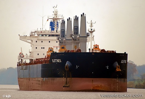
 NORMA
NORMA
Current Status
Where is the vessel?
NORMA is currently in 320 nm NW of Wake Island, based on AIS data received less than 1h ago.
Latest AIS update:
Current position: 21.89522° N, 161.60989° E (320 nm NW of Wake Island)
Average speed (last 7 days): Loading…
Average speed (last 30 days): Loading…
Vessel profile: NORMA is a Bulk Carrier with dimensions 190m x 32m.
This page combines live AIS, route history, probable destination signals, nearby traffic, and port activity for practical vessel monitoring.
The current position of vessel NORMA is 21.89522 lat / 161.60989 lng. Updated: 2026-04-23 11:50:47 UTCNearest reference points:
- Open sea, approx. 407 nm off the nearest listed port
- Open sea, approx. 404 nm off the nearest listed port
- Open sea, approx. 401 nm off the nearest listed port
Currently sailing under the flag of Liberia ![]()
NORMA built in 2010 year
Deadweight:
58018 tDetails:
Live Vessel NORMA Analytics (details, animations, etc.)
Recent AIS points (UTC):
2026-04-23 08:21:45 UTC · 21.79387, 162.24788 · SOG 9.6 kn · COG 284°2026-04-23 09:56:44 UTC · 21.84288, 161.95660 · SOG 10.5 kn · COG 280°
2026-04-23 10:58:18 UTC · 21.87068, 161.77040 · SOG 10 kn · COG 279°
2026-04-23 11:50:47 UTC · 21.89522, 161.60989 · SOG 10.5 kn · COG 280°