 vesseltracker.com
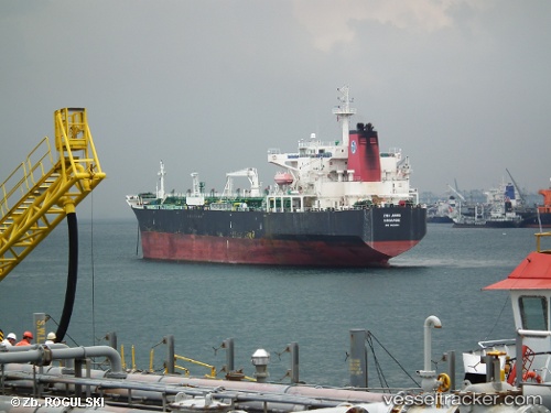
 LAKSHMI
Current Status
Where is the vessel?
LAKSHMI is currently in Near Pachacamac, based on AIS data received about 1h ago.
Latest AIS update:
Current position: 12.25978° S, 76.93164° W (Near Pachacamac)
Average speed (last 7 days): Loading…
Average speed (last 30 days): Loading…
Vessel profile: LAKSHMI is a Oil Products Tanker with dimensions m x m.
This page combines live AIS, route history, probable destination signals, nearby traffic, and port activity for practical vessel monitoring.
The current position of vessel LAKSHMI is -12.25978 lat / -76.93164 lng. Updated: 2026-04-24 22:32:43 UTCNearest reference points:
- Near Callao
- 43 nm SW of Barranca
Currently sailing under the flag of Liberia ![]()
Details:
Live Vessel LAKSHMI Analytics (details, animations, etc.)
Recent AIS points (UTC):
2026-04-24 19:31:09 UTC · -12.25979, -76.93114 · SOG 0 kn · COG 210°2026-04-24 19:58:06 UTC · -12.25980, -76.93116 · SOG 0.2 kn · COG 210°
2026-04-24 22:21:33 UTC · -12.25978, -76.93118 · SOG 0.1 kn · COG 213°
2026-04-24 22:32:43 UTC · -12.25978, -76.93164 · SOG 0 kn · COG 206°