 vesseltracker.com
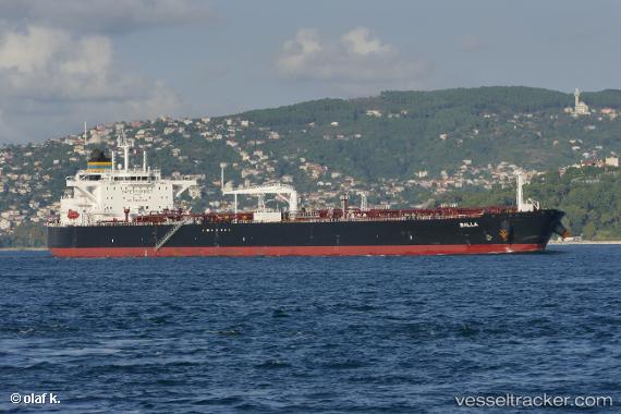
 BALLA
BALLA
Current Status
Where is the vessel?
BALLA is currently in 71 nm W of Yanbu, based on AIS data received less than 1h ago.
Latest AIS update:
Current position: 23.64206° N, 36.82351° E (71 nm W of Yanbu)
Average speed (last 7 days): Loading…
Average speed (last 30 days): Loading…
Vessel profile: BALLA is a Crude Oil Tanker with dimensions 250m x 44m.
This page combines live AIS, route history, probable destination signals, nearby traffic, and port activity for practical vessel monitoring.
The current position of vessel BALLA is 23.64206 lat / 36.82351 lng. Updated: 2026-05-16 11:52:23 UTCNearest reference points:
- 74 nm SW of Yanbu
- 30 nm SW of Yanbu
- 35 nm S of Umm Lajj
Currently sailing under the flag of Liberia ![]()
BALLA built in 2017 year
Deadweight:
113293 tDetails:
Live Vessel BALLA Analytics (details, animations, etc.)
Recent AIS points (UTC):
2026-05-16 08:24:55 UTC · 23.09884, 37.10184 · SOG 10.7 kn · COG 335°2026-05-16 09:25:23 UTC · 23.26333, 37.02272 · SOG 10.7 kn · COG 331°
2026-05-16 11:01:43 UTC · 23.51268, 36.88839 · SOG 10.1 kn · COG 335°
2026-05-16 11:52:23 UTC · 23.64206, 36.82351 · SOG 9.9 kn · COG 335°