 vesseltracker.com
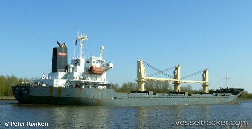
 CECELA S
Current Status
Where is the vessel?
CECELA S is currently in 50 nm NW of Mostaganem, based on AIS data received less than 1h ago.
Latest AIS update:
Current position: 36.68271° N, 0.36725° W (50 nm NW of Mostaganem)
Average speed (last 7 days): Loading…
Average speed (last 30 days): Loading…
Vessel profile: CECELA S is a Bulk Carrier with dimensions m x m.
This page combines live AIS, route history, probable destination signals, nearby traffic, and port activity for practical vessel monitoring.
The current position of vessel CECELA S is 36.68271 lat / -0.36725 lng. Updated: 2026-05-14 16:34:59 UTCNearest reference points:
- 49 nm S of Rejected
- 43 nm NW of Mostaganem
- 50 nm N of Mostaganem
Currently sailing under the flag of Liberia ![]()
Details:
Live Vessel CECELA S Analytics (details, animations, etc.)
Recent AIS points (UTC):
2026-05-14 13:46:11 UTC · 36.78572, 0.29030 · SOG 11.1 kn · COG 262°2026-05-14 14:08:00 UTC · 36.77519, 0.20714 · SOG 11 kn · COG 255°
2026-05-14 15:41:50 UTC · 36.71910, -0.15118 · SOG 11.8 kn · COG 255°
2026-05-14 16:34:59 UTC · 36.68271, -0.36725 · SOG 12.1 kn · COG 263°