 vesseltracker.com
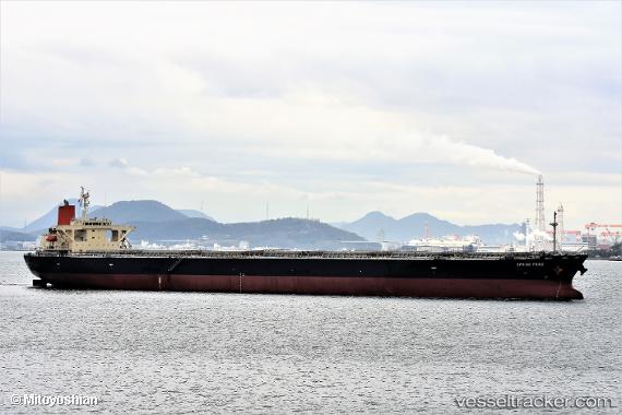
 SEMA M
Current Status
Where is the vessel?
SEMA M is currently in 103 nm S of Kumai, based on AIS data received about 4h ago.
Latest AIS update:
Current position: 4.41158° S, 111.38301° E (103 nm S of Kumai)
Average speed (last 7 days): Loading…
Average speed (last 30 days): Loading…
Vessel profile: SEMA M is a Bulk Carrier with dimensions 43m x 255m.
This page combines live AIS, route history, probable destination signals, nearby traffic, and port activity for practical vessel monitoring.
The current position of vessel SEMA M is -4.41158 lat / 111.38301 lng. Updated: 2026-05-01 17:09:07 UTCNearest reference points:
- 68 nm NW of Gagak Rimang Fso
- 49 nm NE of TANJUNG JATI
- 60 nm NW of Camar Marine Terminal
Currently sailing under the flag of Liberia ![]()
SEMA M built in 2007 year
Deadweight:
106552 tDetails:
Live Vessel SEMA M Analytics (details, animations, etc.)
Recent AIS points (UTC):
2026-05-01 14:41:54 UTC · -4.14467, 110.92790 · SOG 12.7 kn · COG 123°2026-05-01 17:09:07 UTC · -4.41158, 111.38301 · SOG 12.9 kn · COG 123°
2026-05-01 17:09:07 UTC · -4.41158, 111.38301 · SOG 12.9 kn · COG 123°
2026-05-01 17:09:07 UTC · -4.41158, 111.38301 · SOG 12.9 kn · COG 123°