 vesseltracker.com
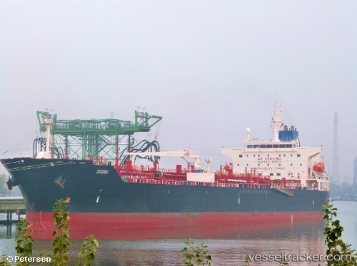
 ST GEORGE
Current Status
Where is the vessel?
ST GEORGE is currently in 24 nm NW of Mölle, based on AIS data received less than 1h ago.
Latest AIS update:
Current position: 56.55210° N, 11.94837° E (24 nm NW of Mölle)
Average speed (last 7 days): Loading…
Average speed (last 30 days): Loading…
Vessel profile: ST GEORGE is a Chemical/Oil Products Tanker with dimensions 32m x 183m.
This page combines live AIS, route history, probable destination signals, nearby traffic, and port activity for practical vessel monitoring.
The current position of vessel ST GEORGE is 56.55210 lat / 11.94837 lng. Updated: 2026-05-15 03:59:17 UTCNearest reference points:
- 11 nm NW of Tisvilde
- Near HUNDESTED
- Near Varberg
Currently sailing under the flag of Liberia ![]()
ST GEORGE built in 2010 year
Deadweight:
50651 tDetails:
Live Vessel ST GEORGE Analytics (details, animations, etc.)
Recent AIS points (UTC):
2026-05-14 22:37:27 UTC · 57.47156, 11.40591 · SOG 10.9 kn · COG 155°2026-05-14 23:58:53 UTC · 57.24186, 11.56539 · SOG 11 kn · COG 165°
2026-05-15 01:14:56 UTC · 57.02424, 11.70259 · SOG 10.9 kn · COG 166°
2026-05-15 03:59:17 UTC · 56.55210, 11.94837 · SOG 11 kn · COG 174°