 vesseltracker.com
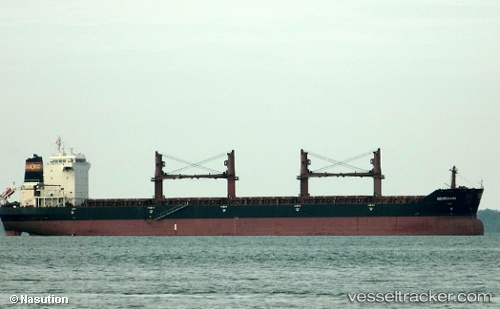
 AE URANUS
Current Status
Where is the vessel?
AE URANUS is currently in 14 nm W of ISABEL, based on AIS data received less than 1h ago.
Latest AIS update:
Current position: 10.85268° N, 124.20613° E (14 nm W of ISABEL)
Average speed (last 7 days): Loading…
Average speed (last 30 days): Loading…
Vessel profile: AE URANUS is a Bulk Carrier with dimensions m x m.
This page combines live AIS, route history, probable destination signals, nearby traffic, and port activity for practical vessel monitoring.
The current position of vessel AE URANUS is 10.85268 lat / 124.20613 lng. Updated: 2026-04-30 19:29:40 UTCNearest reference points:
- Near Danao
- 16 nm E of Danao
- Near Mandaue, Cebu
Currently sailing under the flag of Liberia ![]()
Details:
Live Vessel AE URANUS Analytics (details, animations, etc.)
Recent AIS points (UTC):
2026-04-30 14:46:05 UTC · 11.59625, 123.73373 · SOG 11.3 kn · COG 120°2026-04-30 17:10:00 UTC · 11.29467, 124.09167 · SOG 11.9 kn · COG 142°
2026-04-30 19:12:30 UTC · 10.91023, 124.20253 · SOG 12.1 kn · COG 176°
2026-04-30 19:29:40 UTC · 10.85268, 124.20613 · SOG 12 kn · COG 174°