 vesseltracker.com
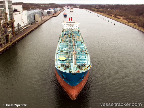
 ROSE I
Current Status
Where is the vessel?
ROSE I is currently in Near AGIOI THEODORI, based on AIS data received about 1h ago.
Latest AIS update:
Current position: 37.91573° N, 23.08611° E (Near AGIOI THEODORI)
Average speed (last 7 days): Loading…
Average speed (last 30 days): Loading…
Vessel profile: ROSE I is a Chemical/Oil Products Tanker with dimensions 185m x 27m.
This page combines live AIS, route history, probable destination signals, nearby traffic, and port activity for practical vessel monitoring.
The current position of vessel ROSE I is 37.91573 lat / 23.08611 lng. Updated: 2026-04-07 10:05:39 UTCNearest reference points:
- Near AGIOI THEODORI
- Near AEGINA BOATYARD
- Near PERDIKA
Currently sailing under the flag of Liberia ![]()
ROSE I built in 2007 year
Deadweight:
37900 tDetails:
Live Vessel ROSE I Analytics (details, animations, etc.)
Recent AIS points (UTC):
2026-04-07 03:59:34 UTC · 37.91572, 23.08609 · SOG 0 kn · COG 223°2026-04-07 05:44:50 UTC · 37.91569, 23.08612 · SOG 0 kn · COG -1°
2026-04-07 07:32:30 UTC · 37.91567, 23.08613 · SOG 0 kn · COG 223°
2026-04-07 10:05:39 UTC · 37.91573, 23.08611 · SOG 0 kn · COG 223°