 vesseltracker.com
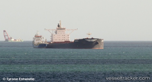
 PAROS
PAROS
Current Status
Where is the vessel?
PAROS is currently in 114 nm W of Aussenkehr, based on AIS data received less than 1h ago.
Latest AIS update:
Current position: 28.71498° S, 15.25770° E (114 nm W of Aussenkehr)
Average speed (last 7 days): Loading…
Average speed (last 30 days): Loading…
Vessel profile: PAROS is a Bulk Carrier with dimensions m x m.
This page combines live AIS, route history, probable destination signals, nearby traffic, and port activity for practical vessel monitoring.
The current position of vessel PAROS is -28.71498 lat / 15.25770 lng. Updated: 2026-05-16 01:25:17 UTCNearest reference points:
- 161 nm W of Koiingnaas
- Near Luderitz Bay
- 154 nm W of Koiingnaas
Currently sailing under the flag of Liberia ![]()
Details:
Live Vessel PAROS Analytics (details, animations, etc.)
Recent AIS points (UTC):
2026-05-15 21:45:18 UTC · -28.21500, 15.02227 · SOG 8.4 kn · COG 155°2026-05-15 22:03:35 UTC · -28.25665, 15.04188 · SOG 8.7 kn · COG 156°
2026-05-15 23:46:25 UTC · -28.49058, 15.15287 · SOG 8.6 kn · COG 157°
2026-05-16 01:25:17 UTC · -28.71498, 15.25770 · SOG 8.7 kn · COG 156°