 vesseltracker.com
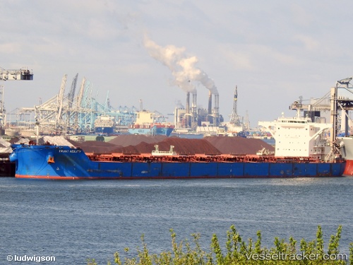
 CAPE PROTEUS
Current Status
Where is the vessel?
CAPE PROTEUS is currently in 60 nm NE of Dung Quat Petroleum Port, based on AIS data received about 5h ago.
Latest AIS update:
Current position: 16.03980° N, 109.62038° E (60 nm NE of Dung Quat Petroleum Port)
Average speed (last 7 days): Loading…
Average speed (last 30 days): Loading…
Vessel profile: CAPE PROTEUS is a Bulk Carrier with dimensions m x m.
This page combines live AIS, route history, probable destination signals, nearby traffic, and port activity for practical vessel monitoring.
The current position of vessel CAPE PROTEUS is 16.03980 lat / 109.62038 lng. Updated: 2026-05-14 22:36:21 UTCNearest reference points:
- 23 nm E of Hai Son
- Near DUNG QUAT
- Near Thuan An
Currently sailing under the flag of Liberia ![]()
Details:
Live Vessel CAPE PROTEUS Analytics (details, animations, etc.)
Recent AIS points (UTC):
2026-05-14 20:05:01 UTC · 16.39012, 109.40003 · SOG 9.6 kn · COG 150°2026-05-14 22:02:31 UTC · 16.12392, 109.58043 · SOG 9.7 kn · COG 154°
2026-05-14 22:28:21 UTC · 16.05977, 109.61103 · SOG 9.8 kn · COG 154°
2026-05-14 22:36:21 UTC · 16.03980, 109.62038 · SOG 9.7 kn · COG 154°