 vesseltracker.com
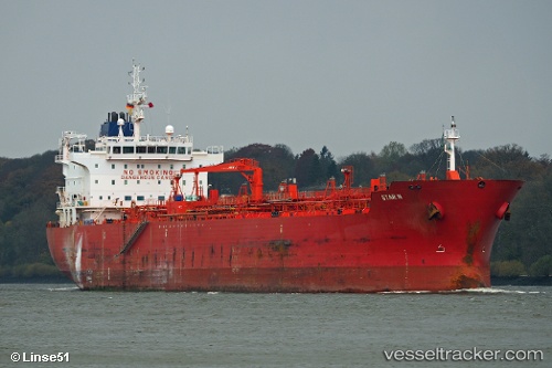
 STAR C
Current Status
Where is the vessel?
STAR C is currently in 31 nm S of Seaford, based on AIS data received less than 1h ago.
Latest AIS update:
Current position: 50.28204° N, 0.19483° W (31 nm S of Seaford)
Average speed (last 7 days): Loading…
Average speed (last 30 days): Loading…
Vessel profile: STAR C is a Chemical Oil Products Tanker with dimensions 184m x 27m.
This page combines live AIS, route history, probable destination signals, nearby traffic, and port activity for practical vessel monitoring.
The current position of vessel STAR C is 50.28204 lat / -0.19483 lng. Updated: 2026-05-14 18:10:28 UTCNearest reference points:
- 27 nm S of Seaford
- 23 nm S of Ferring
- 15 nm S of Selsey
Currently sailing under the flag of Liberia ![]()
STAR C built in 2009 year
Deadweight:
37836 tDetails:
Live Vessel STAR C Analytics (details, animations, etc.)
Recent AIS points (UTC):
2026-05-14 14:05:18 UTC · 50.10147, -1.23964 · SOG 8.6 kn · COG 74°2026-05-14 15:40:37 UTC · 50.16577, -0.84940 · SOG 10.8 kn · COG 76°
2026-05-14 16:32:28 UTC · 50.19292, -0.61340 · SOG 10.2 kn · COG 75°
2026-05-14 18:10:28 UTC · 50.28204, -0.19483 · SOG 10.7 kn · COG 75°