 vesseltracker.com
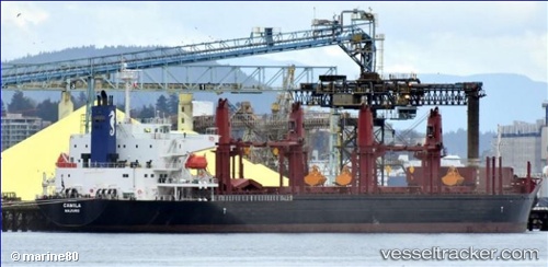
 ADASTAR
Current Status
Where is the vessel?
ADASTAR is currently in Near El Grao, based on AIS data received less than 1h ago.
Latest AIS update:
Current position: 39.97009° N, 0.02498° E (Near El Grao)
Average speed (last 7 days): Loading…
Average speed (last 30 days): Loading…
Vessel profile: ADASTAR is a Cargo with dimensions m x m.
This page combines live AIS, route history, probable destination signals, nearby traffic, and port activity for practical vessel monitoring.
The current position of vessel ADASTAR is 39.97009 lat / 0.02498 lng. Updated: 2026-04-27 22:08:13 UTCNearest reference points:
- Near El Grao
- Near BURRIANA
- Near OROPESA DEL MAR
Currently sailing under the flag of Liberia ![]()
Details:
Live Vessel ADASTAR Analytics (details, animations, etc.)
Recent AIS points (UTC):
2026-04-27 18:08:13 UTC · 39.97006, 0.02505 · SOG 0 kn · COG 142°2026-04-27 19:20:12 UTC · 39.97008, 0.02499 · SOG 0 kn · COG 142°
2026-04-27 19:56:12 UTC · 39.97005, 0.02504 · SOG 0 kn · COG 142°
2026-04-27 22:08:13 UTC · 39.97009, 0.02498 · SOG 0 kn · COG 142°