 vesseltracker.com
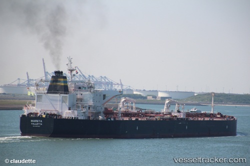
 MARETA
Current Status
Where is the vessel?
MARETA is currently in 91 nm N of Green Turtle Cay, based on AIS data received about 2h ago.
Latest AIS update:
Current position: 28.15452° N, 76.68371° W (91 nm N of Green Turtle Cay)
Average speed (last 7 days): Loading…
Average speed (last 30 days): Loading…
Vessel profile: MARETA is a Crude Oil Tanker with dimensions 249m x 45m.
This page combines live AIS, route history, probable destination signals, nearby traffic, and port activity for practical vessel monitoring.
The current position of vessel MARETA is 28.15452 lat / -76.68371 lng. Updated: 2026-05-15 19:19:05 UTCNearest reference points:
- 75 nm N of Green Turtle Cay
- 113 nm NE of Green Turtle Cay
- Near Green Turtle Cay
Currently sailing under the flag of Liberia ![]()
MARETA built in 2013 year
Deadweight:
115795 tDetails:
Live Vessel MARETA Analytics (details, animations, etc.)
Recent AIS points (UTC):
2026-05-15 15:51:43 UTC · 27.95385, -77.32989 · SOG 11.7 kn · COG 76°2026-05-15 17:21:27 UTC · 28.04620, -77.03445 · SOG 10.3 kn · COG 72°
2026-05-15 18:42:46 UTC · 28.11996, -76.79070 · SOG 10 kn · COG 73°
2026-05-15 19:19:05 UTC · 28.15452, -76.68371 · SOG 10 kn · COG 71°