 vesseltracker.com
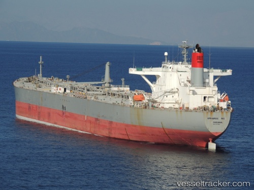
 AFRAMAX RIO
Current Status
Where is the vessel?
AFRAMAX RIO is currently in 137 nm S of Kastellorizou (ex Megísti), based on AIS data received about 2h ago.
Latest AIS update:
Current position: 33.87205° N, 29.56098° E (137 nm S of Kastellorizou (ex Megísti))
Average speed (last 7 days): Loading…
Average speed (last 30 days): Loading…
Vessel profile: AFRAMAX RIO is a Crude Oil Tanker with dimensions m x m.
This page combines live AIS, route history, probable destination signals, nearby traffic, and port activity for practical vessel monitoring.
The current position of vessel AFRAMAX RIO is 33.87205 lat / 29.56098 lng. Updated: 2026-04-27 11:27:16 UTCNearest reference points:
- 108 nm S of Kastellorizou (ex Megísti)
- 129 nm NW of ABU QIR
- 91 nm SE of Polychnitos Lesvou
Currently sailing under the flag of Liberia ![]()
Details:
Live Vessel AFRAMAX RIO Analytics (details, animations, etc.)
Recent AIS points (UTC):
2026-04-27 07:09:59 UTC · 33.28508, 30.23373 · SOG 11.4 kn · COG 305°2026-04-27 09:51:06 UTC · 33.66638, 29.82627 · SOG 11.2 kn · COG 315°
2026-04-27 10:13:16 UTC · 33.71328, 29.76287 · SOG 11.5 kn · COG 312°
2026-04-27 11:27:16 UTC · 33.87205, 29.56098 · SOG 11.2 kn · COG 319°