 vesseltracker.com
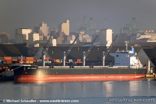
 RED AZALEA
Current Status
Where is the vessel?
RED AZALEA is currently in 13 nm E of Vierow, based on AIS data received less than 1h ago.
Latest AIS update:
Current position: 54.27296° N, 14.13890° E (13 nm E of Vierow)
Average speed (last 7 days): Loading…
Average speed (last 30 days): Loading…
Vessel profile: RED AZALEA is a Cargo with dimensions m x m.
This page combines live AIS, route history, probable destination signals, nearby traffic, and port activity for practical vessel monitoring.
The current position of vessel RED AZALEA is 54.27296 lat / 14.13890 lng. Updated: 2026-05-02 10:41:23 UTCNearest reference points:
- Near Baabe (Ostseebad)
- Near WOLGAST
- Near PEENEMUNDE
Currently sailing under the flag of Liberia ![]()
Details:
Live Vessel RED AZALEA Analytics (details, animations, etc.)
Recent AIS points (UTC):
2026-05-02 07:16:13 UTC · 53.72920, 14.44557 · SOG 11.7 kn · COG 321°2026-05-02 07:51:11 UTC · 53.81404, 14.33058 · SOG 9.2 kn · COG 320°
2026-05-02 09:30:23 UTC · 54.03757, 14.25126 · SOG 12.5 kn · COG 348°
2026-05-02 10:41:23 UTC · 54.27296, 14.13890 · SOG 12.7 kn · COG 298°