 vesseltracker.com
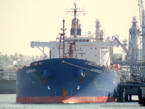
 HARDRADA
Current Status
Where is the vessel?
HARDRADA is currently in 54 nm N of Ayancik, based on AIS data received about 13h ago.
Latest AIS update:
Current position: 42.81593° N, 34.37172° E (54 nm N of Ayancik)
Average speed (last 7 days): Loading…
Average speed (last 30 days): Loading…
Vessel profile: HARDRADA is a Oil Products Tanker with dimensions 180m x 32m.
This page combines live AIS, route history, probable destination signals, nearby traffic, and port activity for practical vessel monitoring.
The current position of vessel HARDRADA is 42.81593 lat / 34.37172 lng. Updated: 2026-04-10 07:03:09 UTCNearest reference points:
- 51 nm N of Sinop
- 18 nm NW of INEBOLU
- 76 nm N of Sinop
Currently sailing under the flag of Liberia ![]()
HARDRADA built in 2007 year
Deadweight:
45983 tDetails:
Live Vessel HARDRADA Analytics (details, animations, etc.)
Recent AIS points (UTC):
2026-04-09 18:33:55 UTC · 44.58361, 38.10925 · SOG 8.1 kn · COG -1°2026-04-09 18:33:55 UTC · 44.58361, 38.10925 · SOG 8.1 kn · COG -1°
2026-04-09 18:33:55 UTC · 44.58361, 38.10925 · SOG 8.1 kn · COG -1°
2026-04-10 07:03:09 UTC · 42.81593, 34.37172 · SOG 12.3 kn · COG -1°