 vesseltracker.com
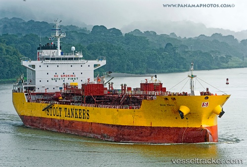
 BRAVE OCEAN
Current Status
Where is the vessel?
BRAVE OCEAN is currently in 351 nm S of Harper, based on AIS data received less than 1h ago.
Latest AIS update:
Current position: 1.40147° S, 8.62229° W (351 nm S of Harper)
Average speed (last 7 days): Loading…
Average speed (last 30 days): Loading…
Vessel profile: BRAVE OCEAN is a Oil/Chemical Tanker with dimensions m x m.
This page combines live AIS, route history, probable destination signals, nearby traffic, and port activity for practical vessel monitoring.
The current position of vessel BRAVE OCEAN is -1.40147 lat / -8.62229 lng. Updated: 2026-05-15 03:43:14 UTCNearest reference points:
- Open sea, approx. 400 nm off the nearest listed port
- Open sea, approx. 401 nm off the nearest listed port
- Open sea, approx. 402 nm off the nearest listed port
Currently sailing under the flag of Liberia ![]()
Details:
Live Vessel BRAVE OCEAN Analytics (details, animations, etc.)
Recent AIS points (UTC):
2026-05-14 22:55:11 UTC · -2.17833, -7.98500 · SOG 12 kn · COG -1°2026-05-14 23:46:12 UTC · -2.04021, -8.09820 · SOG 12.5 kn · COG 322°
2026-05-15 01:05:37 UTC · -1.82552, -8.27167 · SOG 12.3 kn · COG 322°
2026-05-15 03:43:14 UTC · -1.40147, -8.62229 · SOG 12.6 kn · COG 318°