 vesseltracker.com
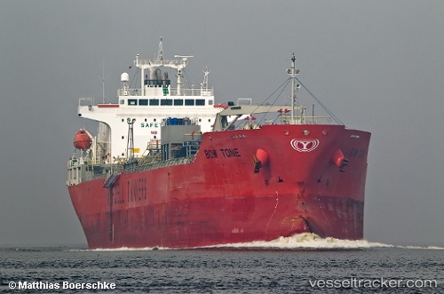
 TG CRAB
Current Status
Where is the vessel?
TG CRAB is currently in 132 nm NE of Suqutrá, based on AIS data received about 1h ago.
Latest AIS update:
Current position: 13.52152° N, 55.99233° E (132 nm NE of Suqutrá)
Average speed (last 7 days): Loading…
Average speed (last 30 days): Loading…
Vessel profile: TG CRAB is a Oil/Chemical Tanker with dimensions m x m.
This page combines live AIS, route history, probable destination signals, nearby traffic, and port activity for practical vessel monitoring.
The current position of vessel TG CRAB is 13.52152 lat / 55.99233 lng. Updated: 2026-05-16 02:32:09 UTCNearest reference points:
- 103 nm S of Port Raysut
Currently sailing under the flag of Liberia ![]()
Details:
Live Vessel TG CRAB Analytics (details, animations, etc.)
Recent AIS points (UTC):
2026-05-15 21:52:47 UTC · 13.28967, 56.72687 · SOG 9.4 kn · COG 294°2026-05-15 23:50:16 UTC · 13.38112, 56.42453 · SOG 9.5 kn · COG 293°
2026-05-16 01:09:54 UTC · 13.45093, 56.21427 · SOG 9.3 kn · COG 293°
2026-05-16 02:32:09 UTC · 13.52152, 55.99233 · SOG 10.2 kn · COG 291°