 vesseltracker.com
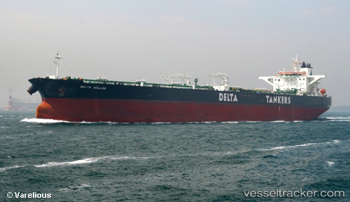
 DELTA HELLAS
Current Status
Where is the vessel?
DELTA HELLAS is currently in 57 nm S of Sarinena, based on AIS data received less than 1h ago.
Latest AIS update:
Current position: 40.83705° N, 10.11020° W (57 nm S of Sarinena)
Average speed (last 7 days): Loading…
Average speed (last 30 days): Loading…
Vessel profile: DELTA HELLAS is a Crude Oil Tanker with dimensions m x m.
This page combines live AIS, route history, probable destination signals, nearby traffic, and port activity for practical vessel monitoring.
The current position of vessel DELTA HELLAS is 40.83705 lat / -10.11020 lng. Updated: 2026-05-14 18:04:31 UTCNearest reference points:
- 52 nm W of Canas de Santa Maria
- 11 nm S of Sarinena
- 20 nm SE of Bear River City
Currently sailing under the flag of Liberia ![]()
Details:
Live Vessel DELTA HELLAS Analytics (details, animations, etc.)
Recent AIS points (UTC):
2026-05-14 12:55:52 UTC · 41.85074, -10.10163 · SOG 11.6 kn · COG 181°2026-05-14 12:55:52 UTC · 41.85074, -10.10163 · SOG 11.6 kn · COG 181°
2026-05-14 16:20:50 UTC · 41.17861, -10.10622 · SOG 11.6 kn · COG 183°
2026-05-14 18:04:31 UTC · 40.83705, -10.11020 · SOG 11.6 kn · COG 180°