 vesseltracker.com
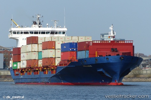
 NETA A.
Current Status
Where is the vessel?
NETA A. is currently in 21 nm S of Åkirkeby, based on AIS data received less than 1h ago.
Latest AIS update:
Current position: 54.72673° N, 14.86131° E (21 nm S of Åkirkeby)
Average speed (last 7 days): Loading…
Average speed (last 30 days): Loading…
Vessel profile: NETA A. is a Container Ship with dimensions m x m.
This page combines live AIS, route history, probable destination signals, nearby traffic, and port activity for practical vessel monitoring.
The current position of vessel NETA A. is 54.72673 lat / 14.86131 lng. Updated: 2026-04-25 22:14:27 UTCNearest reference points:
- Near TEJN
- Near KOLOBRZEG
- Near Baabe (Ostseebad)
Currently sailing under the flag of Liberia ![]()
Details:
Live Vessel NETA A. Analytics (details, animations, etc.)
Recent AIS points (UTC):
2026-04-25 19:14:44 UTC · 55.07380, 16.04480 · SOG 14.6 kn · COG 243°2026-04-25 19:45:03 UTC · 55.06133, 16.00457 · SOG 14.5 kn · COG 243°
2026-04-25 21:54:28 UTC · 54.76411, 14.98541 · SOG 14.5 kn · COG 243°
2026-04-25 22:14:27 UTC · 54.72673, 14.86131 · SOG 14.7 kn · COG 243°