 vesseltracker.com
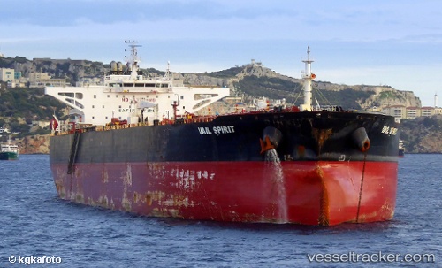
 STALLION
Current Status
Where is the vessel?
STALLION is currently in Near Das Island, based on AIS data received less than 1h ago.
Latest AIS update:
Current position: 25.10098° N, 52.95582° E (Near Das Island)
Average speed (last 7 days): Loading…
Average speed (last 30 days): Loading…
Vessel profile: STALLION is a Crude Oil Tanker with dimensions m x m.
This page combines live AIS, route history, probable destination signals, nearby traffic, and port activity for practical vessel monitoring.
The current position of vessel STALLION is 25.10098 lat / 52.95582 lng. Updated: 2026-04-23 23:56:15 UTCNearest reference points:
- Near Das Island
- Near Yas Island
- 21 nm NE of Halul Island
Currently sailing under the flag of Liberia ![]()
Details:
Live Vessel STALLION Analytics (details, animations, etc.)
Recent AIS points (UTC):
2026-04-23 20:20:14 UTC · 25.10101, 52.95462 · SOG 0.2 kn · COG 36°2026-04-23 21:23:15 UTC · 25.10071, 52.95580 · SOG 0.1 kn · COG 12°
2026-04-23 21:56:19 UTC · 25.10085, 52.95646 · SOG 0 kn · COG 3°
2026-04-23 23:56:15 UTC · 25.10098, 52.95582 · SOG 0 kn · COG 24°