 vesseltracker.com
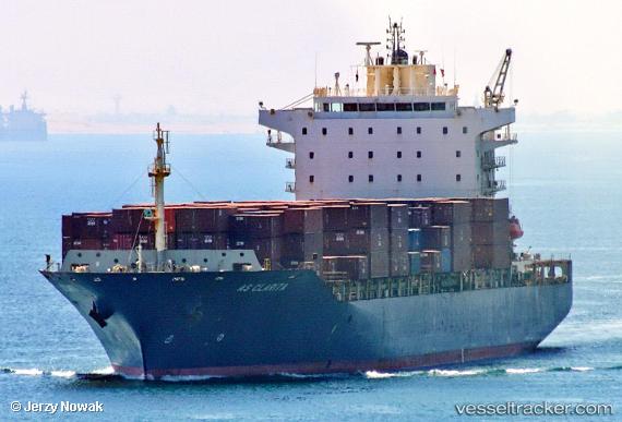
 MSC CLARITA III
Current Status
Where is the vessel?
MSC CLARITA III is currently in 23 nm NW of Eydilos, based on AIS data received about 2h ago.
Latest AIS update:
Current position: 37.90238° N, 25.82888° E (23 nm NW of Eydilos)
Average speed (last 7 days): Loading…
Average speed (last 30 days): Loading…
Vessel profile: MSC CLARITA III is a Container Ship with dimensions m x m.
This page combines live AIS, route history, probable destination signals, nearby traffic, and port activity for practical vessel monitoring.
The current position of vessel MSC CLARITA III is 37.90238 lat / 25.82888 lng. Updated: 2026-05-15 01:06:47 UTCNearest reference points:
- 13 nm NW of Karkinagri Ikarias
- Near CESME
- Near MYKONOS OLD PORT
Currently sailing under the flag of Liberia ![]()
Details:
Live Vessel MSC CLARITA III Analytics (details, animations, etc.)
Recent AIS points (UTC):
2026-05-14 21:35:48 UTC · 37.32001, 26.15484 · SOG 12 kn · COG 308°2026-05-14 22:43:07 UTC · 37.44015, 25.91919 · SOG 11.8 kn · COG 303°
2026-05-15 00:00:37 UTC · 37.68693, 25.86137 · SOG 11.9 kn · COG 351°
2026-05-15 01:06:47 UTC · 37.90238, 25.82888 · SOG 11.8 kn · COG 351°