 vesseltracker.com
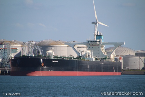
 IVORY C. PROSPERITY
Current Status
Where is the vessel?
IVORY C. PROSPERITY is currently in 199 nm SE of SUR, based on AIS data received about 1h ago.
Latest AIS update:
Current position: 21.14733° N, 62.75771° E (199 nm SE of SUR)
Average speed (last 7 days): Loading…
Average speed (last 30 days): Loading…
Vessel profile: IVORY C. PROSPERITY is a Crude Oil Tanker with dimensions m x m.
This page combines live AIS, route history, probable destination signals, nearby traffic, and port activity for practical vessel monitoring.
The current position of vessel IVORY C. PROSPERITY is 21.14733 lat / 62.75771 lng. Updated: 2026-04-27 10:19:14 UTCNearest reference points:
- 224 nm E of SUR
- 262 nm SE of SUR
- 171 nm E of SUR
Currently sailing under the flag of Liberia ![]()
Details:
Live Vessel IVORY C. PROSPERITY Analytics (details, animations, etc.)
Recent AIS points (UTC):
2026-04-27 07:29:55 UTC · 21.49714, 62.35290 · SOG 10.5 kn · COG 133°2026-04-27 08:03:35 UTC · 21.43190, 62.43111 · SOG 10.5 kn · COG 133°
2026-04-27 10:19:14 UTC · 21.14733, 62.75771 · SOG 12.9 kn · COG 131°
2026-04-27 10:19:14 UTC · 21.14733, 62.75771 · SOG 12.9 kn · COG 131°