 vesseltracker.com
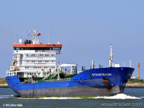
 STENSTRAUM
Current Status
Where is the vessel?
STENSTRAUM is currently in Near Church Bay, Rathlin Island, based on AIS data received about 115d ago.
Latest AIS update:
Current position: 55.32485° N, 6.10461° W (Near Church Bay, Rathlin Island)
Average speed (last 7 days): Loading…
Average speed (last 30 days): Loading…
Vessel profile: STENSTRAUM is a Chemical/Oil Products Tanker with dimensions 145m x 21m.
This page combines live AIS, route history, probable destination signals, nearby traffic, and port activity for practical vessel monitoring.
The current position of vessel STENSTRAUM is 55.32485 lat / -6.10461 lng. Updated: 2026-01-19 01:15:26 UTCNearest reference points:
- Near Belfast
- Near Southend
- Near Campbeltown
Currently sailing under the flag of Liberia ![]()
STENSTRAUM built in 2001 year
Deadweight:
13677 tDetails:
Live Vessel STENSTRAUM Analytics (details, animations, etc.)
Recent AIS points (UTC):
2026-01-19 01:15:26 UTC · 55.32485, -6.10461 · SOG 8.1 kn · COG 136°