 vesseltracker.com
 BELMONTE
Current Status
Where is the vessel?
BELMONTE is currently in 31 nm S of El Alquian, based on AIS data received less than 1h ago.
Latest AIS update:
Current position: 36.36470° N, 2.13806° W (31 nm S of El Alquian)
Average speed (last 7 days): Loading…
Average speed (last 30 days): Loading…
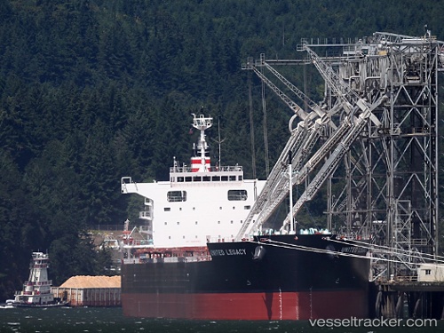
Vessel profile: BELMONTE is a Bulk Carrier with dimensions 225m x 225m.
This page combines live AIS, route history, probable destination signals, nearby traffic, and port activity for practical vessel monitoring.
The current position of vessel BELMONTE is 36.36470 lat / -2.13806 lng. Updated: 2026-05-14 23:47:14 UTCNearest reference points:
- 27 nm SE of El Alquian
- 26 nm S of El Alquian
- 37 nm S of Las Noras de Daza
Currently sailing under the flag of Liberia ![]()
BELMONTE built in 2014 year
Deadweight:
81344 tDetails:
Live Vessel BELMONTE Analytics (details, animations, etc.)
Recent AIS points (UTC):
2026-05-14 19:51:03 UTC · 36.25194, -3.06369 · SOG 11.6 kn · COG 81°2026-05-14 22:22:24 UTC · 36.32429, -2.47822 · SOG 11.5 kn · COG 79°
2026-05-14 22:57:54 UTC · 36.33938, -2.33739 · SOG 11.8 kn · COG 81°
2026-05-14 23:47:14 UTC · 36.36470, -2.13806 · SOG 11.8 kn · COG 82°