 vesseltracker.com
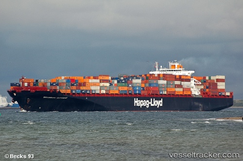
 YANTIAN EXPRESS
Current Status
Where is the vessel?
YANTIAN EXPRESS is currently in 55 nm S of Morehead City, based on AIS data received less than 1h ago.
Latest AIS update:
Current position: 33.72983° N, 76.67784° W (55 nm S of Morehead City)
Average speed (last 7 days): Loading…
Average speed (last 30 days): Loading…
Vessel profile: YANTIAN EXPRESS is a Container Ship with dimensions m x m.
This page combines live AIS, route history, probable destination signals, nearby traffic, and port activity for practical vessel monitoring.
The current position of vessel YANTIAN EXPRESS is 33.72983 lat / -76.67784 lng. Updated: 2026-05-15 17:55:58 UTCNearest reference points:
- Near Morehead City
- Near BEAUFORT
- 11 nm N of BEAUFORT
Currently sailing under the flag of Liberia ![]()
Details:
Live Vessel YANTIAN EXPRESS Analytics (details, animations, etc.)
Recent AIS points (UTC):
2026-05-15 13:47:27 UTC · 34.38541, -75.69733 · SOG 14.9 kn · COG 231°2026-05-15 16:07:16 UTC · 34.03302, -76.24215 · SOG 15.8 kn · COG 232°
2026-05-15 16:14:47 UTC · 34.01500, -76.27500 · SOG 16 kn · COG -1°
2026-05-15 17:55:58 UTC · 33.72983, -76.67784 · SOG 14.7 kn · COG 235°