 vesseltracker.com
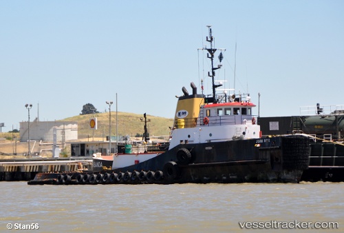
John Brix
Current StatusWhere is the vessel?
John Brix is currently in 28 nm SW of Tatoosh Island, based on AIS data received less than 1h ago.
Latest AIS update:
Current position: 48.04196° N, 125.19402° W (28 nm SW of Tatoosh Island)
Average speed (last 7 days): Loading…
Average speed (last 30 days): Loading…
Vessel profile: John Brix is a Tug with dimensions 12m x 42m.
This page combines live AIS, route history, probable destination signals, nearby traffic, and port activity for practical vessel monitoring.
The current position of vessel John Brix is 48.04196 lat / -125.19402 lng. Updated: 2026-05-15 00:08:11 UTCNearest reference points:
- 21 nm NW of Tatoosh Island
- Near Clallam Bay
- Near Colwood
Details:
Live Vessel John Brix Analytics (details, animations, etc.)
Recent AIS points (UTC):
2026-05-14 19:59:53 UTC · 48.41020, -124.94591 · SOG 5.7 kn · COG 210°2026-05-14 22:06:10 UTC · 48.22776, -125.06965 · SOG 5.8 kn · COG 208°
2026-05-14 22:21:00 UTC · 48.20610, -125.08402 · SOG 5.9 kn · COG 207°
2026-05-15 00:08:11 UTC · 48.04196, -125.19402 · SOG 6.2 kn · COG 206°