 vesseltracker.com
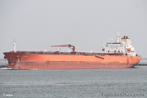
 APATE
APATE
Current Status
Where is the vessel?
APATE is currently in Near Baniyas, based on AIS data received less than 1h ago.
Latest AIS update:
Current position: 35.20564° N, 35.91330° E (Near Baniyas)
Average speed (last 7 days): Loading…
Average speed (last 30 days): Loading…
Vessel profile: APATE is a Oil Products Tanker with dimensions m x m.
This page combines live AIS, route history, probable destination signals, nearby traffic, and port activity for practical vessel monitoring.
The current position of vessel APATE is 35.20564 lat / 35.91330 lng. Updated: 2026-04-30 14:02:04 UTCNearest reference points:
- Near Al Ladhiqiyah
- Near Tartous
- Near Al Latakia
Currently sailing under the flag of Madagascar ![]()
Details:
Live Vessel APATE Analytics (details, animations, etc.)
Recent AIS points (UTC):
2026-04-30 10:51:03 UTC · 35.20569, 35.91303 · SOG 0 kn · COG 190°2026-04-30 11:36:43 UTC · 35.20569, 35.91320 · SOG 0 kn · COG 194°
2026-04-30 13:38:04 UTC · 35.20567, 35.91331 · SOG 0 kn · COG 194°
2026-04-30 14:02:04 UTC · 35.20564, 35.91330 · SOG 0 kn · COG 197°