 vesseltracker.com
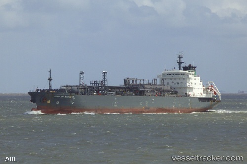
 ROYAL H
Current Status
Where is the vessel?
ROYAL H is currently in 10 nm E of SHINAS, based on AIS data received about 2h ago.
Latest AIS update:
Current position: 24.76897° N, 56.66009° E (10 nm E of SHINAS)
Average speed (last 7 days): Loading…
Average speed (last 30 days): Loading…
Vessel profile: ROYAL H is a Lpg Tanker with dimensions m x m.
This page combines live AIS, route history, probable destination signals, nearby traffic, and port activity for practical vessel monitoring.
The current position of vessel ROYAL H is 24.76897 lat / 56.66009 lng. Updated: 2026-05-16 09:41:15 UTCNearest reference points:
- 18 nm SE of SHINAS
- 17 nm SE of Shinas
- Near Fujairah
Currently sailing under the flag of Malawi ![]()
Details:
Live Vessel ROYAL H Analytics (details, animations, etc.)
Recent AIS points (UTC):
2026-05-16 07:01:07 UTC · 24.76956, 56.66049 · SOG 0.1 kn · COG 12°2026-05-16 08:10:48 UTC · 24.76965, 56.66009 · SOG 0.1 kn · COG 29°
2026-05-16 09:41:15 UTC · 24.76897, 56.66009 · SOG 0.1 kn · COG 79°
2026-05-16 09:41:15 UTC · 24.76897, 56.66009 · SOG 0.1 kn · COG 79°