 vesseltracker.com
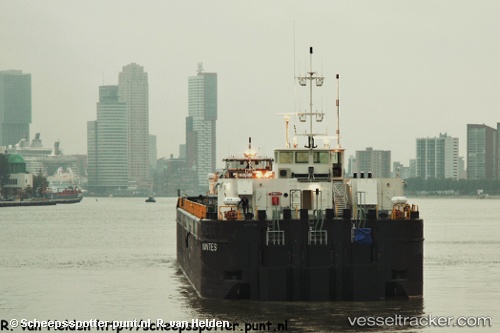
Ntugbu 1
Current StatusWhere is the vessel?
Ntugbu 1 is currently in Near Port Harcourt, based on AIS data received about 772d ago.
Latest AIS update:
Current position: 4.79671° N, 6.93927° E (Near Port Harcourt)
Average speed (last 7 days): Loading…
Average speed (last 30 days): Loading…
Vessel profile: Ntugbu 1 is a Oil Products Tanker with dimensions 16m x 108m.
This page combines live AIS, route history, probable destination signals, nearby traffic, and port activity for practical vessel monitoring.
The current position of vessel Ntugbu 1 is 4.79671 lat / 6.93927 lng. Updated: 2024-03-12 10:17:35 UTCNearest reference points:
- Near Port Harcourt
- Near Onne
- Near Bonny
Details:
Live Vessel Ntugbu 1 Analytics (details, animations, etc.)
Recent AIS points (UTC):
2024-03-12 10:17:35 UTC · 4.79671, 6.93927 · SOG 0 kn · COG -1°