 vesseltracker.com
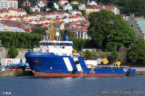
 OCEANIC FRONTIER
Current Status
Where is the vessel?
OCEANIC FRONTIER is currently in 16 nm S of Ketu, based on AIS data received less than 1h ago.
Latest AIS update:
Current position: 6.36612° N, 3.91737° E (16 nm S of Ketu)
Average speed (last 7 days): Loading…
Average speed (last 30 days): Loading…
Vessel profile: OCEANIC FRONTIER is a Offshore Supply Ship with dimensions m x m.
This page combines live AIS, route history, probable destination signals, nearby traffic, and port activity for practical vessel monitoring.
The current position of vessel OCEANIC FRONTIER is 6.36612 lat / 3.91737 lng. Updated: 2026-04-28 09:59:42 UTCNearest reference points:
- Near Lagos
- Near Apapa
- Near Kirikiri
Currently sailing under the flag of Nigeria ![]()
Details:
Live Vessel OCEANIC FRONTIER Analytics (details, animations, etc.)
Recent AIS points (UTC):
2026-04-28 06:08:05 UTC · 6.36705, 3.91682 · SOG 0.1 kn · COG 242°2026-04-28 08:04:26 UTC · 6.36500, 3.91667 · SOG 0 kn · COG -1°
2026-04-28 08:12:55 UTC · 6.36631, 3.91728 · SOG 0 kn · COG 246°
2026-04-28 09:59:42 UTC · 6.36612, 3.91737 · SOG 0 kn · COG 238°